The Socastee Swing bridge started operation today. Yeah -- we can continue on, however the bridge operator -- Howard very helpful -- said the clearance on the bridge just past him was only 56 feet instead of the usual 65 feet. We need to be careful of the bridges -- we are 57 feet off the water.
Boy the cruiser flood gates will be open tomorrow with most boats on the move again.
Today was just a chore day. We got a shuttle ride to the grocery store -- round trip only $15. We went to a Lowes which was nice but prices were higher than we have at home. Then back on the boat to do a couple of loads of laundry and fill the water tanks.
Tonight I went to a free symposium here at the marina on problem areas along the ICW South of here and weather for offshore passages. It was presented by Hank Pomeranz, retired US Navy Meteorologist and owner of CYC - Carolina Yacht Care, also the driver of our shuttle this morning.
The presentation was excellent -- better than anything I've seen before. He gave us a handout of all the slides he presented which were all in color and detailed snippets of charts and the best route through the trouble areas. I highly recommend attending one of these briefs when stopping at the Southport marina. They are free and absolutely GREAT.
We hope to leave early tomorrow and run down to Barefoot Landing and stop at a marina for the night -- no good anchorages on this hop.
Saturday, October 22, 2016
Friday, October 21, 2016
Almost ate with the fishes at Fishy Fishy Cafe
Another beautiful mild day here in Southport, however, it was supposed to be terrible -- reason why we came in here.
The weather is still great here at 4:15pm. There was supposed to be a monster cold front coming across today at noon but it is a no show so far.
We walked about town a bit this morning and stopped at the famous Fishy Fishy cafe for lunch. Karen had the fish taco with grouper and I had the Fishy Fishy basket with shrimp -- both were great. However after awhile folks started complaining that the couldn't leave!! The high tide had come in and coupled with the flooding Cape Fear River the establishment was surrounded by water and it was rising! Fortunately they laid out some scaffolding planks between the entrance and the dry side of the road so we could leave. Probably that dry side was going under soon.
We wandered into a couple the tourist shops near there but they were having to contend with the rising waters too. Apparently the flood waters from Hurricane Matthew were just cresting down here now -- nearly 2 weeks later.
A big problem we are facing is that this late flooding has closed the Socaste Bridge over the ICW -- just passed Myrtle Beach and no boats are getting thru. We need to wait a little longer here or maybe in Myrtle Beach before we can go on or possibly go offshore from Cape Fear to Wynyah Bay near Georgetown, SC. Decisions Decisions, it is all part of the game.


Thursday, October 20, 2016
Tense moments on ICW and Cape Fear was a pussy cat today
We had a nice quiet night in Wrightsville Beach last night. One poor cruiser - a Canadian - on MYLADY had double trouble yesterday. They ran aground just south of Figure Eight Island bridge and called for a Boat US tow and then about an hour and half later they called Boat US for another tow -- they were hard aground at G25 - entry to Motts channel. Boat US was good natured about it and told them they didn't need to pass their member info again.. Big Whup.
We left the anchorage at 7:30am and hit the Carolina Beach trouble area around 10am and about 2 hours before high tide. There were 5 can buoys there marking the channel which did not match the chart (Garman Blue Chart) but I found a lot of water -- minimum 11 feet. The only problem there was a very strong current coming across which moved to the red side and I had to take a sharp turn to offset. There is shoaling in Snows Cut but well marked. Follow the buoys and not the chart through here.
Cape Fear River was nearly a mill pond. Never have we found it so docile. We did have to fight the current most of the way but not too bad. Lots of small debris in the water which caused us to be ever vigilant and not use the auto pilot.
We made Southport Marina around noon and went in for fuel and a slip for a few days. Strong cold front coming across tomorrow so we elected to stop here till probably Sunday. This will give us a chance to explore this picturesque town.
The marina is fine but the dock hands are not fully up to the game. Not good line handlers. they didn't do us any favors. After fueling at the fuel dock I had to turn around and cross back across another dock and work may slowly around a corner to the slip. The slip is okay but a starboard tie is inconvenient since we have to walk around the power cord. The dock we were warned is quite "tender" in that it rocks vigorously as you walk across it -- these are floating docks.
The docks themselves are very nice and easy on the feet.
Well we are going to be dirt dwellers for a few days. The ground felt funny since we have not been off the boat since last Saturday.
Wednesday, October 19, 2016
Aaaack! ICW sucks today
We had a long run to Wrightsville beach from Mile Hammock today. It was another picture perfect day except for the trouble spots on the ICW. The NEw River inlet was not an issue -- just watch the marks. There were a few "catch your breath moments as we approached the Figure 8 Island bridge but the worst was just passed the bridge and in Wrightsville -- specifically Motts Channel.
Around marker G123 you need to hug right up next to the docks to get through. Close to G123 and you will be aground. Two sailboats behind us found that out. Then at G25 when you enter Motts channel you need to hug the Green side until pass the third pier on the red side. After that watch the marks and not the chart plotter. My Garmin Blue Chart would have had us going behind marks.
The Wrightsville anchorage was not too crowded but the bottom humbled my Rocna Anchor. We found a nice spot near the dinghy docks but the Rocna would not grab, that and 20 feet of water!. We anchored in the "back row" with 14 feet. A little close to some other boats but holding is good.
NOW Soap Box time. What do all these 30 - 40 year olds do for a living down here? I couldn't believe how many able body adults are out playing on the waterway at 11am... All I can think of is "Social Security Disability"!! Man I was in the office all day at that age on a weekday. The Federal government has made it too easy to not work and collect benefits. This especially riles me since there is NO MONEY to do upkeep on the ICW!! Man Priorities!!
Sorry..
We are just spending the night here then on to Southport in the morning. That will be the last fine day for awhile. A "monster" cold front is forecast to come across Friday afternoon/evening so we want to be in and tied up. Good time to get fuel, laundry, and maybe a dinner out.
Tuesday, October 18, 2016
Marker 61A Bah Humbug!
Boy we couldn't get much of a break today on the current. It seemed to slow us down most of the morning.
We just plodded along until we got to Swansboro and then a familiar voice came over the radio hailing Temptation. It was JilliQ. We had met them in Hopetown Abacos back in the winter of 2015. They had remembered us.
They are heading back there again this year. Said they were there last year and it was busy.
It was another fine day for weather and we just enjoyed the bright sunny, light wind, ride until we got to the famous S curve at marker 61A. On the ICW the red 62 and Green 61A are in a straight line -- almost. In the past 61A is up very near the shore and you pass between the marker and the shore. Active Captain's comments said this marker is off station and too near the shore. JilliQ went by earlier and radioed back that they thought it was still off station and passed it as a red marker and off by 20feet and found a minimum of 9' water.
I looked at it and sure enough it looked to be only 20 feet from the shore. No way we can travel between it and the shore so I treated it as a red marker and found a minimum of 9.9 feet. Whew -- made it through.
We made Mile Hammock bay around 1pm and only one boat -- a trawler -- in fact the one "Cozy Kady" that left Spooners Creek at first light was there. We anchored and relaxed. Later more Trawlers came in and anchored. What I noticed about them is that after they anchor the go inside and never come out! They have these beautiful sun roofs, and back porches and they don't use them. Probably inside surfing the internet.
This afternoon we heard 3 boats had called towing services because they had run aground near that marker 61A. Oh what a pity. I feel for them. Fortunately Active captains comments and JilliQ's tip saved us from a similar grounding. I hate running aground.
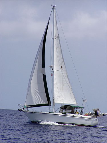
Nice breeze here in Mile Hammock this afternoon and my wind generator that replaced the bearings in this summer is running great. In the past it would not start in 10kts of wind -- needed 12 or better.
Nice to see things turning out nicely.
Tomorrow it's Wrightsville Beach for the night and some world famous Robert's Grocery Chicken salad. I'm drooling already.
We just plodded along until we got to Swansboro and then a familiar voice came over the radio hailing Temptation. It was JilliQ. We had met them in Hopetown Abacos back in the winter of 2015. They had remembered us.
They are heading back there again this year. Said they were there last year and it was busy.
It was another fine day for weather and we just enjoyed the bright sunny, light wind, ride until we got to the famous S curve at marker 61A. On the ICW the red 62 and Green 61A are in a straight line -- almost. In the past 61A is up very near the shore and you pass between the marker and the shore. Active Captain's comments said this marker is off station and too near the shore. JilliQ went by earlier and radioed back that they thought it was still off station and passed it as a red marker and off by 20feet and found a minimum of 9' water.
I looked at it and sure enough it looked to be only 20 feet from the shore. No way we can travel between it and the shore so I treated it as a red marker and found a minimum of 9.9 feet. Whew -- made it through.
We made Mile Hammock bay around 1pm and only one boat -- a trawler -- in fact the one "Cozy Kady" that left Spooners Creek at first light was there. We anchored and relaxed. Later more Trawlers came in and anchored. What I noticed about them is that after they anchor the go inside and never come out! They have these beautiful sun roofs, and back porches and they don't use them. Probably inside surfing the internet.
This afternoon we heard 3 boats had called towing services because they had run aground near that marker 61A. Oh what a pity. I feel for them. Fortunately Active captains comments and JilliQ's tip saved us from a similar grounding. I hate running aground.
Nice breeze here in Mile Hammock this afternoon and my wind generator that replaced the bearings in this summer is running great. In the past it would not start in 10kts of wind -- needed 12 or better.
Nice to see things turning out nicely.
Tomorrow it's Wrightsville Beach for the night and some world famous Robert's Grocery Chicken salad. I'm drooling already.
Monday, October 17, 2016
Flood waters met their match AND it is a small world
We had a peasant evening on the hook in Cedar Creek last night. We were away early this morning with a fog forming. It didn't take long and it was thick but 20 minutes later lifted -- just in time to see a barge coming towards us. Good thing we didn't need to negoitiate that in the fog.
We were approaching high tide and the current was coming towards us from the ocean. My friends and I argued over what would happen when the flooding waters of the Neuse River met the incoming tide. I said the tide would be overwhelmed and we would have favorable current all the way. My friend Jim said no you will probably see standing waves when the two meet. What happened is that the incoming tide just coursed as usual and overwhelmed us -- our speed was down to 4kts through the Core Creek Bridge. Should have been 6.4kts with no tide affect. Oh well now we know.
As we entered the Newport River the sailing vessel Antares passed us. Hmmm could that be the Will and Muffin we met in Hopetown Abacos 2 years ago?? A trawler came by and passed them. They called them on the radio an sure enough Will's voice -- the voice from the cruisers net in Abacos came back. Then Muffin called another boat.
What are the odds. We heard they were heading back to the Abacos this season.
We made it into Spooners creek early -- like 11:30am. Relaxed a few minutes then had lunch. Afterwards I got the scuba gear out and dove on the boat to change the zincs an scrub the bottom. Well I found the zincs just fine. Visibility was fair but they could wait for the clear water of the Bahamas. I scrubbed the boat bottom and it was just slime with some barnacles. Prop was fine. Should run faster tomorrow.
Here at 4:45pm only one other boat has joined us here and anchored.
The weather looks very mild for a few days yet so we will push on towards Wrightsville Beach and hopefully cross the Cape Fear River on Thursday before forecast inclement weather for Friday and Saturday come in. We will either stop at the Myrtle Beach yacht club or Barefoot Landing for the bad weather.
Sunday, October 16, 2016
And AWAY we GO!!
Yipeeee - we left the dock this morning. We left on a short shake down cruise to Cedar Creek near the mouth of Adams creek for the night. It was really only a run of 25 miles. Fortunately we hadn't planned to leave early because there was thick fog about. Even at 10am when we left it was still a bit foggy but lifting rapidly.
I'm glad we decided to start with short hops at first so we could get back into the swing of things. Even though we have been boating for better than 25 years it still takes time to get the rhythm back.
This morning I had a HUGE brain "short circuit". I was bringing all the systems online and needed to reinsert the knot meter transducer back into the hull of the boat. We take it out when the boat isn't used frequently so it doesn't foul with growth. I pulled the dummy transducer out which went smoothly and inserted the real transducer. I tried to screw the collar down but it wouldn't catch. It just went round and round and the whole time water is rushing in until this is secured. After a good minute I tried to put the dummy plug back and it wouldn't thread on either. Ohhh great I have the inch and half hole in the boat and water is coming in. I took a deep breath before calling for help -- probably will have to be dragged to a marina and hauled out when it dawned on my "righty tighty, lefty loosey". Crap I was turning the locking nut in the wrong direction. Hell that is like forgetting how to put shoes on!! Well righty tighty got it secured. That was a scary start.
The rest of the trip went without mishap. We made Cedar Creek around 1:30pm and only one boat was already here. Now at 5:15pm we have 4 boats here -- all snowbirds heading south.
The weather is GREAT with light wind and a high in the 70s and a low in the 60s. No weather forecast until Friday so we are enjoying it.
Tomorrow will be another short hop to Spooners Creek to anchor. The weather is fairly clean there and I plan to change zincs and clean the hull before moving on. This will all be done with my scuba gear. Hopefully won't take more than an hour and half.
Looking forward to nice night on the hook here tonight with a nearly full moon.
Subscribe to:
Comments (Atom)